News Summary
Columbia, South Carolina, experienced severe weather conditions this Sunday morning as tornado and thunderstorm warnings were issued. With high winds and a risk of localized flooding, residents were urged to take precautions. A tornado was spotted moving towards Lake Murray, intensifying concerns. A lake wind advisory was also in effect due to expected strong winds. Despite the chaos, the forecast promises clear skies and warmer weather ahead. Residents are advised to stay informed as situations develop.
Severe Thunderstorm and Tornado Warnings Rock Columbia, South Carolina!
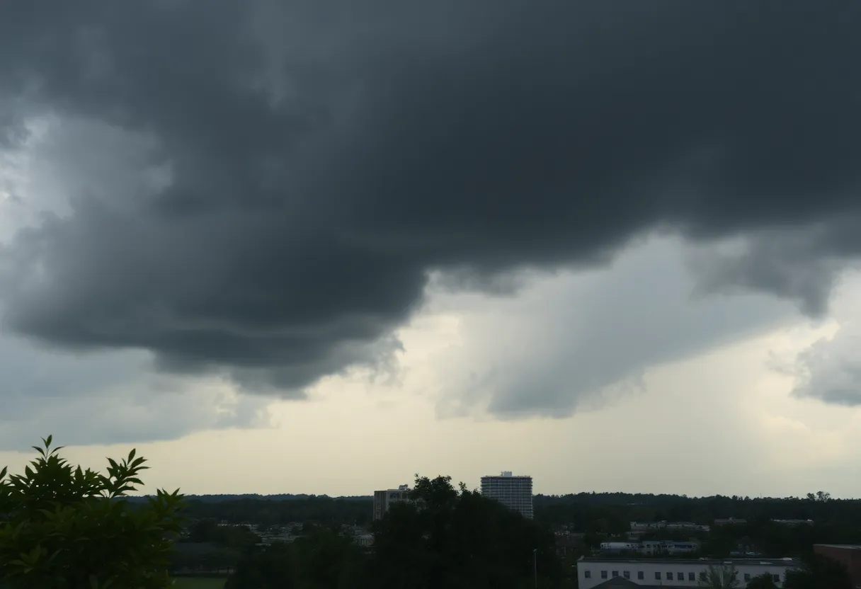
The charming city of Columbia, South Carolina, faced an intense showdown with Mother Nature this Sunday morning, as severe thunderstorm and tornado warnings sent residents scurrying for safety. It’s been quite a ride with conditions swinging from breezy and warm to downright stormy!
The Storm Arrives
At the crack of dawn, Columbia found itself under a severe thunderstorm warning that was set to expire at 8:30 a.m. But that wasn’t the only concern for locals. A tornado warning had also been issued and was in effect until 8:15 a.m.—heightening the tension in the air as residents braced for the worst. The National Weather Service (NWS) confidently shared that the severe weather could linger in the Midlands all the way until Sunday afternoon, keeping everyone on high alert.
A Tornado Watch in Effect
To add another layer of unease, a tornado watch stretched across Richland County, Lexington County, and nearly all surroundings. The watch included areas such as Kershaw, Calhoun, Clarendon, Lee, and even Orangeburg counties! The NWS had its eyes particularly peeled on the eastern part of the Midlands, reporting an increased tornado threat there.
Spotting a Tornado!
The dramatic morning escalated quickly when, at 7:43 a.m., people in Dreher Island spotted a tornado on the move toward Lake Murray and the dam. With winds gusting up to 60 mph, this was not an average storm! Indeed, the conditions were shaping up to give us strong thunderstorms, localized flash flooding, and—let’s not forget—gusty winds that could whip into a frenzy!
Possible Damaging Effects
This whirlwind of activity has the potential to wreak havoc on Columbia’s landscape. Tornadoes and those strong winds could spell disaster for trees, mobile homes, roofs, and outbuildings, bringing about some serious risks. Even vehicles parked outside could find themselves in harm’s way if a tornado strikes nearby. And let’s face it—a fallen tree on a power line doesn’t make for a good morning, leading to outages that could leave many in the dark.
Be Aware on the Water
While storms raged on land, a lake wind advisory was issued for the Midlands as well, remaining effective until 8 p.m. With strong winds expected to reach 25 mph and gusts hitting 40 mph, those hoping to enjoy an early morning on the lake were advised to think twice. We all know that safety comes first!
Rainpour Expected
Rain was projected to pour into Columbia, with a whopping 90% chance of precipitation. Up to half an inch—or more—of localized rainfall might drench the area, so it’s best to have those umbrellas handy or stay cozy indoors!
Sunny Days Ahead
But not to worry, after this battering storm blows through, Columbia can look forward to some lovely weather! The forecast predicts the skies clearing, leading to warmer days ahead. Enjoy relief from the chaos as temperatures comfortably rise from the 60s, peaking at a delightful 78 degrees by Wednesday. The promise of good weather will be a welcome change after the stormy scene.
Stay Tuned!
As situations concerning severe weather develop, it’s a good idea for residents to keep an eye on updates. The skies may be tumultuous today, but brighter days are surely on the horizon for the resilient city of Columbia!
Deeper Dive: News & Info About This Topic
- The State
- Wikipedia: Tornado Warning
- Post and Courier
- Google Search: Columbia Severe Weather
- Fox Weather
- Encyclopedia Britannica: Tornado
- WLTX
- Google News: Columbia Severe Thunderstorm

Author: STAFF HERE CHARLESTON
The CHARLESTON STAFF WRITER represents the experienced team at HEREcharleston.com, your go-to source for actionable local news and information in Charleston, Charleston County, and beyond. Specializing in "news you can use," we cover essential topics like product reviews for personal and business needs, local business directories, politics, real estate trends, neighborhood insights, and state news affecting the area—with deep expertise drawn from years of dedicated reporting and strong community input, including local press releases and business updates. We deliver top reporting on high-value events such as the Spoleto Festival USA, Charleston Wine + Food Festival, and the MOJA Festival. Our coverage extends to key organizations like the Charleston Metro Chamber of Commerce and the Charleston Museum, plus leading businesses in tourism and maritime industries that power the local economy such as South Carolina Ports Authority and the Charleston Visitor Center. As part of the broader HERE network, including HEREaiken.com, HEREbeaufort.com, HEREchapin.com, HEREcharleston.com, HEREclinton.com, HEREcolumbia.com, HEREgeorgetown.com, HEREgreenwood.com, HEREgreenville.com, HEREhiltonhead.com, HEREirmo.com, HEREmyrtlebeach.com, HEREnewberry.com, HERErockhill.com, HEREspartanburg.com, HEREaustin.com, HEREcollegestation.com, HEREdallas.com, HEREhouston.com, and HEREsanantonio.com, we provide comprehensive, credible insights into South Carolina's dynamic landscape.